Story
Adapting Actively on the Fly: Relevance-Guided Online Meta-Learning with Latent Concepts for Geospatial Discovery
Key takeaway
Scientists developed an AI system that can efficiently explore and discover new information in complex, changing environments by learning what data to focus on. This could help with tasks like environmental monitoring and disaster response.
Quick Explainer
The proposed framework, called OWL-GPS, addresses the challenge of efficiently discovering targets of interest in large, dynamically evolving geospatial environments. It combines a concept-guided relevance encoder, which learns how different factors influence target presence, with a relevance-aware meta-training strategy and an active sampling mechanism that balances exploration and exploitation. This enables the model to continuously adapt to changes in the environment and make sample-efficient discoveries, even with sparse and biased ground truth. The key innovations are the interpretable relevance representations and the online meta-learning approach tailored to the spatially continuous, non-stationary nature of the problem.
Deep Dive
Technical Deep Dive: Adapting Actively on the Fly
Overview
This paper presents a novel framework, called Open-World Learning for Geospatial Prediction and Sampling (OWL-GPS), for efficient target discovery in large, costly-to-sample, and dynamically evolving geospatial environments. The key innovations are:
- A concept-guided relevance encoder that leverages readily-available domain concepts to learn interpretable relevance vectors, capturing how different factors influence target presence.
- A relevance-aware meta-training strategy that forms diverse, high-utility meta-batches on the fly, better suited for spatially continuous, non-stationary settings compared to static-buffer or episodic approaches.
- An active sampling mechanism that combines uncertainty-based exploration and relevance-guided exploitation, enabling sample-efficient learning during training and effective target discovery during inference.
The framework is validated on two real-world discovery tasks - PFAS hotspot detection and rare land cover identification - demonstrating robust performance under sparse supervision and distribution shift.
Problem & Context
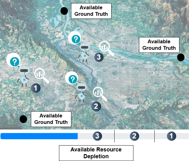
The paper addresses the challenge of efficiently discovering targets of interest (e.g., pollution hotspots, damaged regions, disease-prone areas) in large, costly-to-sample, and dynamically evolving geospatial environments. Key aspects of the problem include:
- Strict sampling budgets: only ~100 interaction steps are allowed during deployment, typical for real-world tasks like environmental monitoring.
- Sparse and biased ground truth: previous observations are limited, making decision-making highly uncertain.
- Non-stationarity: the environment and underlying data distributions may shift over time, requiring continuous adaptation.
- Spatial and semantic structure: observations are highly correlated, and understanding latent relationships is critical for efficient search.
Traditional approaches like reinforcement learning and POMDPs struggle with these constraints, motivating the need for a novel framework tailored to the OWL-GPS setting.
Methodology
The proposed framework comprises three key components:
- Concept Encoder:
- Learns low-dimensional representations of readily-available domain concepts (e.g., land cover, facility proximity) using a generative model.
- Applies Gram-Schmidt orthogonalization to promote diversity and reduce redundancy among the concept axes.
- Relevance Encoder and Decoder:
- Models the relevance of each concept to the target presence as a latent variable using a Conditional Variational Autoencoder (CVAE).
- Learns to predict target presence by integrating the relevance vectors and concept representations.
- Online Meta-Training and Sampling:
- Employs an online meta-learning approach to continuously adapt the model parameters as new observations arrive.
- Dynamically constructs meta-training batches using a Greedy Intersection Clustering algorithm to promote diverse and informative samples.
- Combines uncertainty-based exploration and relevance-guided exploitation for active sample selection during both training and inference.
Data & Experimental Setup
The framework is evaluated on two real-world datasets:
- PFAS Contamination Prediction:
- Predicting the presence of per- and polyfluoroalkyl substances (PFAS) in the environment using multi-channel satellite imagery.
- Covers diverse U.S. regions, with only 704 labeled sample points across the dataset.
- Rare Land Cover Identification:
- Identifying the water class within Sentinel-2 imagery, despite visually similar categories (e.g., ice).
- Uses a sparsified version of the dataset to simulate limited supervision.
Experiments are conducted to assess performance on both spatial and temporal generalization, with training on 2019 data and testing on 2021 data for the PFAS task.
Results
- The proposed framework outperforms several baselines, including active learning, meta-learning, and bandit-based approaches, on both the PFAS and land cover tasks.
- On the PFAS task, the framework maintains a high Success Rate (SR) of 95% under a sampling budget of 50, with strong predictive performance across accuracy, F-score, precision, and recall metrics.
- When evaluated on 2021 PFAS data, the framework demonstrates consistent performance, highlighting its ability to generalize across time.
- Ablation studies confirm the importance of the relevance encoder, meta-training set formation, and relevance-guided sampling in driving the framework's effectiveness.
Interpretation
- The learned relevance vectors align well with known environmental factors influencing PFAS presence, such as land cover, facility proximity, and hydrological connectivity, demonstrating the model's ability to capture meaningful domain knowledge.
- Visualizations of the relevance space and saliency maps show a clear progression from exploration to exploitation, validating the framework's capacity to balance discovery and targeted sampling.
Limitations & Uncertainties
- The framework relies on the availability of domain-specific concepts, which may limit its applicability in unstructured tasks without clear environmental drivers.
- While the framework is designed to be memory-efficient, the computational cost of the meta-training set formation step may be a bottleneck for deployment at very large scale.
- The study uses simulated label sparsity for the land cover task, and the real-world implications of such sparsity remain to be tested.
What Comes Next
- Explore strategies to further reduce the computational burden of meta-training set formation, potentially through efficient clustering or approximate methods.
- Investigate the framework's performance on a wider range of geospatial discovery tasks, including those with less structured environmental factors.
- Develop mechanisms to incorporate user feedback and domain expert knowledge into the framework's decision-making process.